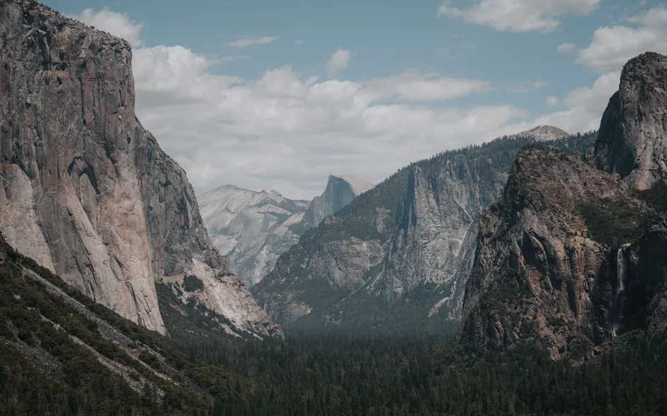
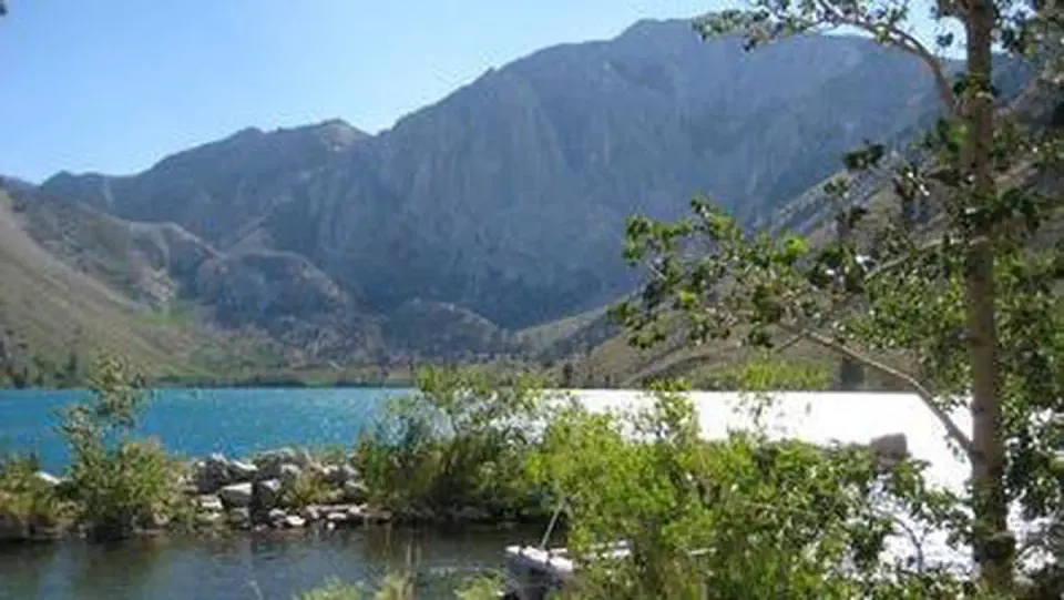
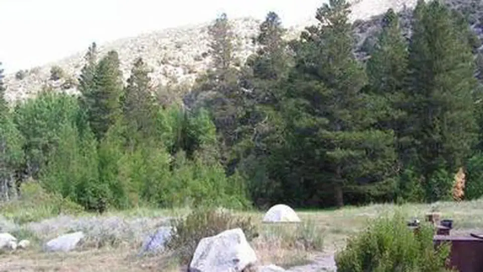
Overview McGee Campground provides a pleasant, sunny location for family camping between Bishop and Mammoth Lakes in the eastern Sierra Nevada Mountains. The campground's proximity to U.S. Highway 395 and the adjacent John Muir Wilderness make it a hot spot for hiking, rock climbing, fishing, wildlife viewing, horseback riding, hunting, photography and geology study. Recreation Majestic scenery and challenging trails draw in hikers, mountain bikers and equestrian enthusiasts. The McGee Creek Trailhead, a popular trail for hiking and horseback riding into the McGee Canyon area of the John Muir Wilderness, lies just two miles from the campground. The eastern Sierras are known for exceptional trout fishing. McGee Creek and nearby Crowley Lake have some of the best fishing in the area. The area's interesting geology also makes it popular for rock hounding. Facilities McGee offers about 28 reservable, open and sunny campsites. Each site has a picnic shelter. Roads and camping spurs are paved. Bear-proof lockers are provided for food storage and firewood is for sale on-site. Natural Features The campground is situated in an expanse of silvery white sagebrush and near a meadow lined with aspens. It sits at an elevation of 7,600 feet and offers outstanding views of high mountain peaks in the John Muir Wilderness. McGee Creek runs alongside it, with some sites sitting along the banks of the water. Nearby Attractions For campers interested in local events, Mule Days are held in Bishop over Memorial Day weekend, and the Mammoth Jazz Jubilee is hosted in Mammoth in mid-July. Visitors can explore the magnificent John Muir Wilderness, which stretches for 100 miles along the crest of the Sierra Nevada Mountains. It is a land of lofty snow-capped mountains, deep canyons and vast expanses of glacially-carved terrain, and offers extensive hiking, mountain biking and horseback riding trails.
Mcgee Creek
Near McGee Creek CDP, California · 37.56444, -118.78472
About Mcgee Creek
Overview McGee Campground provides a pleasant, sunny location for family camping between Bishop and Mammoth Lakes in the eastern Sierra Nevada Mountains. The campground's proximity to U.S. Highway 395 and the adjacent John Muir Wilderness make it a hot spot for hiking, rock climbing, fishing, wildlife viewing, horseback riding, hunting, photography and geology study. Recreation Majestic scenery and challenging trails draw in hikers, mountain bikers and equestrian enthusiasts. The McGee Creek Trailhead, a popular trail for hiking and horseback riding into the McGee Canyon area of the John Muir Wilderness, lies just two miles from the campground. The eastern Sierras are known for exceptional trout fishing. McGee Creek and nearby Crowley Lake have some of the best fishing in the area. The area's interesting geology also makes it popular for rock hounding. Facilities McGee offers about 28 reservable, open and sunny campsites. Each site has a picnic shelter. Roads and camping spurs are paved. Bear-proof lockers are provided for food storage and firewood is for sale on-site. Natural Features The campground is situated in an expanse of silvery white sagebrush and near a meadow lined with aspens. It sits at an elevation of 7,600 feet and offers outstanding views of high mountain peaks in the John Muir Wilderness. McGee Creek runs alongside it, with some sites sitting along the banks of the water. Nearby Attractions For campers interested in local events, Mule Days are held in Bishop over Memorial Day weekend, and the Mammoth Jazz Jubilee is hosted in Mammoth in mid-July. Visitors can explore the magnificent John Muir Wilderness, which stretches for 100 miles along the crest of the Sierra Nevada Mountains. It is a land of lofty snow-capped mountains, deep canyons and vast expanses of glacially-carved terrain, and offers extensive hiking, mountain biking and horseback riding trails.
Campground calendar
Live from Recreation.gov, refreshed every 10 minutes. Booking happens only on the official page.
- A Available
- R Reserved
- F First-come, first-served
- X Not reservable / not available
- NYR Not yet released
Individual campsites (28)
Site-level fields prevent campground amenities from being applied to every campsite. Open a site for its photos, dimensions and fit check.
Permitted equipment: Tent, RV ≤ 22 ft, Trailer ≤ 22 ft
Permitted equipment: Tent, RV ≤ 22 ft, Trailer ≤ 22 ft
Permitted equipment: Tent, RV ≤ 22 ft, Trailer ≤ 22 ft
Permitted equipment: Tent, RV ≤ 20 ft, Trailer ≤ 20 ft
Permitted equipment: Tent, RV ≤ 24 ft, Trailer ≤ 24 ft
Permitted equipment: Tent, RV ≤ 20 ft, Trailer ≤ 20 ft
Permitted equipment: Tent, RV ≤ 20 ft, Trailer ≤ 20 ft
Permitted equipment: Tent, RV ≤ 21 ft, Trailer ≤ 21 ft
Permitted equipment: Tent, RV ≤ 24 ft, Trailer ≤ 24 ft
Permitted equipment: Tent, RV ≤ 20 ft, Trailer ≤ 20 ft
Permitted equipment: Trailer ≤ 30 ft, Tent ≤ 30 ft, RV ≤ 30 ft
Permitted equipment: Tent ≤ 30 ft, RV ≤ 30 ft, Trailer ≤ 30 ft
Permitted equipment: Trailer ≤ 30 ft, Tent ≤ 30 ft, RV ≤ 30 ft
Permitted equipment: Trailer ≤ 30 ft, Tent ≤ 30 ft, RV ≤ 30 ft
Permitted equipment: Trailer ≤ 30 ft, Tent ≤ 30 ft, RV ≤ 30 ft
Permitted equipment: Trailer ≤ 35 ft, Tent ≤ 35 ft, RV ≤ 35 ft
Permitted equipment: Trailer ≤ 30 ft, Tent ≤ 30 ft, RV ≤ 30 ft
Permitted equipment: Trailer ≤ 35 ft, Tent ≤ 35 ft, RV ≤ 35 ft
Permitted equipment: RV ≤ 20 ft, Trailer ≤ 20 ft, Tent
Permitted equipment: Tent, RV ≤ 24 ft, Trailer ≤ 24 ft
Permitted equipment: Trailer ≤ 30 ft, Tent ≤ 30 ft, RV ≤ 30 ft
Permitted equipment: Trailer ≤ 30 ft, Tent ≤ 30 ft, RV ≤ 30 ft
Permitted equipment: Tent, RV ≤ 22 ft, Trailer ≤ 22 ft
Permitted equipment: Tent, RV ≤ 24 ft, Trailer ≤ 24 ft
Show the remaining 4 sites
Permitted equipment: Tent, RV ≤ 16 ft, Trailer ≤ 16 ft
Permitted equipment: Tent, RV ≤ 24 ft, Trailer ≤ 24 ft
Permitted equipment: Tent, RV ≤ 20 ft, Trailer ≤ 20 ft
Permitted equipment: RV ≤ 22 ft, Trailer ≤ 22 ft, Tent
Facility rates
Facility rates by season dates, as published on Recreation.gov.
No Rates Available
* Displayed rates do not reflect discounts, taxes, or incremental charges. Current fees are confirmed only on Recreation.gov.
Facility information
Official activities, amenities, directions, contact details and links from the managing agency's record.
- Managed by
- FS
- Recreation area
- Inyo National Forest
- Facility type
- Campground
- Near
- McGee Creek CDP, California
Directions
From U.S. Highway 395 in California, take the McGee Creek exit, located 8 miles south of Mammoth Lakes and 37 miles north of Bishop. Proceed 2 miles south up the paved McGee Creek Road. The campground is on the left.
Contact
The twelve questions campers actually ask
Each answer carries its source and verification date. “Not verified” is deliberately different from “No”.
Price and extra fees
Official source · Recreation.gov RIDB · verified Oct 20, 2026Report / correctNo verified nightly, weekly or monthly rate on file. We never estimate prices. · Report / correct
Booking and arrival
Imported data · Recreation.gov campsite data · verified Oct 20, 2026Report / correctOfficial booking / provider page — availability is only confirmed there.
Check-in time comes from individual campsite records on Recreation.gov; confirm with the facility.
Late-arrival policy has not been verified. Call ahead before arriving after office hours.
RV compatibility
Imported data · Recreation.gov campsite data · verified Oct 20, 2026Report / correctReal campsite photos
UnknownReport / correctNo camper has photographed a specific site yet. Add the first one.
Amenities
Official source · Recreation.gov RIDB · verified Oct 20, 2026Report / correctCampground-level flags mean the amenity is reported somewhere in the campground, not at every site.
Quietness
Report / correct- 0 moderated noise reports; at least 3 are needed before an indicator is shown.
A quietness score is never manufactured — it needs at least three moderated reports. Add yours.
Cell signal & internet
Report / correctNo carrier or speed reports yet. Tower locations are not presented as proof of coverage. · Report / correct
Pet rules
Imported data · Recreation.gov campsite data · verified Oct 20, 2026Report / correctAccessibility
Report / correct- Step-free site access: information unavailable
- Accessible restroom: information unavailable
- Accessible shower: information unavailable
- Firm, stable pathways: information unavailable
- Short distance to facilities: information unavailable
- Accessible parking: information unavailable
- Accessible picnic table: information unavailable
- Accessible trail: information unavailable
Facility-level features and individual-site accessibility are listed separately; one accessible amenity never makes the whole campground accessible.
Road access
Report / correctOfficial directions: From U.S. Highway 395 in California, take the McGee Creek exit, located 8 miles south of Mammoth Lakes and 37 miles north of Bishop. Proceed 2 miles south up the paved McGee Creek Road. The campground is on the left.
Road access never implies camping permission; motor-vehicle maps and directions are not legal authorisation.
Weather and restrictions
Report / correctWeather and alerts
Loading the official National Weather Service forecast…
Recent camper reports
Report / correctNo moderated camper reports yet. · Report / correct
Add a structured report ↓ — noise, road, internet, arrival, pets, accessibility, price or closure.
Will my RV fit?
Compares your rig with each imported campsite's documented entry type, driveway length, surface, grade, overhead clearance and hookups. Sign in to use a saved vehicle, or enter dimensions below.
What the actual site looks like
Photos are attached to a site number only when the contributor stated it; moderators remove location metadata and reject unsupported associations.
No camper photos for this site yet
Be the first to add what the pad, entrance and approach road really look like.
Add a photo of a specific campsite
Report conditions or correct a fact
Structured reports are reviewed before they appear. They add evidence next to official data; they never replace it silently.
Source and freshness
Sources: Recreation.gov RIDB full export (facility, campsites, media, links, activities, addresses), Recreation.gov site data (notices, rules, seasons & fees, amenities, ratings), Campsite Atlas baseline, moderated camper reports and verified park submissions where shown.
RIDB export synchronized: 10/20/2026, 2:10:24 PM (record last updated by the agency 9/1/2026)
Recreation.gov site data synchronized: Pending
View official/source record
Keep exploring
If this campground is full or closed, these are the closest alternatives with their own verification status.