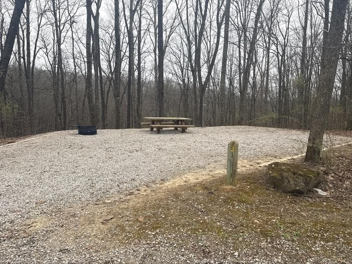
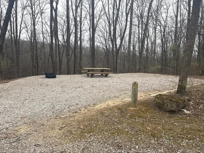
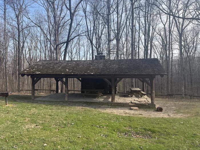
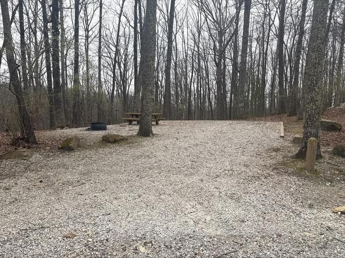
01Loop A · STANDARD NONELECTRIC · OvernightPeople 16 peopleVehicles UnknownMax vehicle UnknownEntry UnknownDriveway 12 ft · gravelSite size 7×7 ftTent pad 18×? ftShade PartialCampfire YesElectric UnknownWater hookup NoSewer No hookupPets YesCheck-in / out UnknownSite rating UnknownLocation rating GoodCapacity rating DoubleAccess Drive-In
02Loop A · STANDARD NONELECTRIC · OvernightPeople 8 peopleVehicles UnknownMax vehicle UnknownEntry UnknownDriveway 12 ft · gravelSite size 7×7 ftTent pad 18×? ftShade PartialCampfire YesElectric UnknownWater hookup NoSewer No hookupPets YesCheck-in / out UnknownSite rating UnknownLocation rating GoodCapacity rating SingleAccess Drive-In
03Loop A · STANDARD NONELECTRIC · OvernightPeople 8 peopleVehicles UnknownMax vehicle UnknownEntry UnknownDriveway 12 ft · gravelSite size 7×7 ftTent pad 18×? ftShade PartialCampfire YesElectric UnknownWater hookup NoSewer No hookupPets YesCheck-in / out UnknownSite rating UnknownLocation rating GoodCapacity rating SingleAccess Drive-In
04Loop A · STANDARD NONELECTRIC · OvernightPeople 8 peopleVehicles UnknownMax vehicle UnknownEntry UnknownDriveway 12 ft · gravelSite size 7×7 ftTent pad 18×? ftShade PartialCampfire YesElectric UnknownWater hookup NoSewer No hookupPets YesCheck-in / out UnknownSite rating UnknownLocation rating GoodCapacity rating SingleAccess Drive-In
05Loop A · STANDARD NONELECTRIC · OvernightPeople 8 peopleVehicles UnknownMax vehicle UnknownEntry UnknownDriveway 12 ft · gravelSite size 7×7 ftTent pad 18×? ftShade PartialCampfire YesElectric UnknownWater hookup NoSewer No hookupPets YesCheck-in / out UnknownSite rating UnknownLocation rating GoodCapacity rating SingleAccess Drive-In
06Loop A · STANDARD NONELECTRIC · OvernightPeople 16 peopleVehicles UnknownMax vehicle UnknownEntry UnknownDriveway 12 ft · gravelSite size 7×7 ftTent pad 18×? ftShade PartialCampfire YesElectric UnknownWater hookup NoSewer No hookupPets YesCheck-in / out UnknownSite rating UnknownLocation rating GoodCapacity rating DoubleAccess Drive-In
07Loop A · STANDARD NONELECTRIC · OvernightPeople 8 peopleVehicles UnknownMax vehicle UnknownEntry UnknownDriveway 12 ft · gravelSite size 7×7 ftTent pad 18×? ftShade PartialCampfire YesElectric UnknownWater hookup NoSewer No hookupPets YesCheck-in / out UnknownSite rating UnknownLocation rating GoodCapacity rating SingleAccess Drive-In
08Loop A · STANDARD NONELECTRIC · OvernightPeople 8 peopleVehicles UnknownMax vehicle UnknownEntry UnknownDriveway 12 ft · gravelSite size 7×7 ftTent pad 18×? ftShade PartialCampfire YesElectric UnknownWater hookup NoSewer No hookupPets YesCheck-in / out UnknownSite rating UnknownLocation rating GoodCapacity rating SingleAccess Drive-In
09Loop A · STANDARD NONELECTRIC · OvernightPeople 8 peopleVehicles UnknownMax vehicle UnknownEntry UnknownDriveway 12 ft · gravelSite size 7×7 ftTent pad 18×? ftShade PartialCampfire YesElectric UnknownWater hookup NoSewer No hookupPets YesCheck-in / out UnknownSite rating UnknownLocation rating GoodCapacity rating SingleAccess Drive-In
10Loop A · STANDARD NONELECTRIC · OvernightPeople 16 peopleVehicles UnknownMax vehicle UnknownEntry UnknownDriveway 12 ft · gravelSite size 7×7 ftTent pad 18×? ftShade PartialCampfire YesElectric UnknownWater hookup NoSewer No hookupPets YesCheck-in / out UnknownSite rating UnknownLocation rating GoodCapacity rating DoubleAccess Drive-In
11Loop B · STANDARD NONELECTRIC · OvernightPeople 8 peopleVehicles UnknownMax vehicle UnknownEntry UnknownDriveway 12 ft · gravelSite size 7×7 ftTent pad 18×? ftShade PartialCampfire YesElectric UnknownWater hookup NoSewer No hookupPets YesCheck-in / out UnknownSite rating UnknownLocation rating GoodCapacity rating SingleAccess Drive-In
12Loop B · STANDARD NONELECTRIC · OvernightPeople 16 peopleVehicles UnknownMax vehicle UnknownEntry UnknownDriveway 12 ft · gravelSite size 7×7 ftTent pad 18×? ftShade PartialCampfire YesElectric UnknownWater hookup NoSewer No hookupPets YesCheck-in / out UnknownSite rating UnknownLocation rating GoodCapacity rating DoubleAccess Drive-In
13Loop B · STANDARD NONELECTRIC · OvernightPeople 8 peopleVehicles UnknownMax vehicle UnknownEntry UnknownDriveway 12 ft · gravelSite size 7×7 ftTent pad 18×? ftShade PartialCampfire YesElectric UnknownWater hookup NoSewer No hookupPets YesCheck-in / out UnknownSite rating UnknownLocation rating GoodCapacity rating SingleAccess Drive-In
14Loop B · STANDARD NONELECTRIC · OvernightPeople 16 peopleVehicles UnknownMax vehicle UnknownEntry UnknownDriveway 12 ft · gravelSite size 7×7 ftTent pad 18×? ftShade PartialCampfire YesElectric UnknownWater hookup NoSewer No hookupPets YesCheck-in / out UnknownSite rating UnknownLocation rating GoodCapacity rating DoubleAccess Drive-In
15Loop B · STANDARD NONELECTRIC · OvernightPeople 16 peopleVehicles UnknownMax vehicle UnknownEntry UnknownDriveway 12 ft · gravelSite size 7×7 ftTent pad 18×? ftShade PartialCampfire YesElectric UnknownWater hookup NoSewer No hookupPets YesCheck-in / out UnknownSite rating UnknownLocation rating GoodCapacity rating DoubleAccess Drive-In
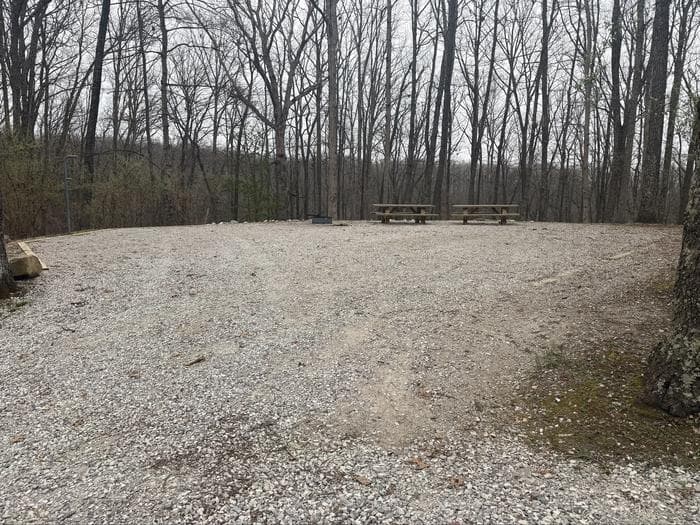
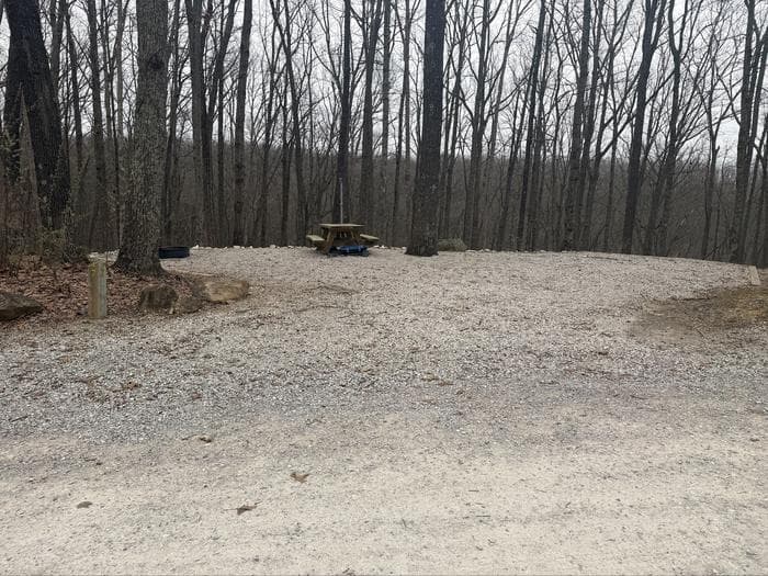
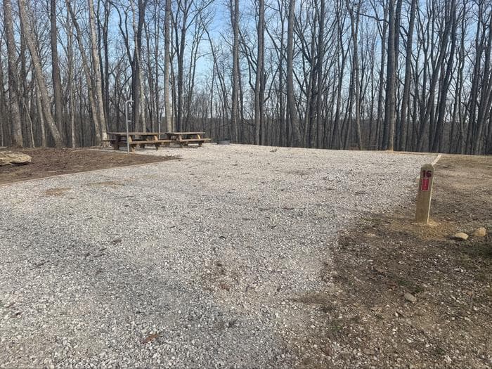
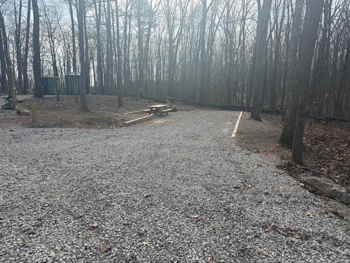
16Loop B · STANDARD NONELECTRIC · OvernightPeople 16 peopleVehicles UnknownMax vehicle UnknownEntry UnknownDriveway 12 ft · gravelSite size 7×7 ftTent pad 18×? ftShade PartialCampfire YesElectric UnknownWater hookup NoSewer No hookupPets YesCheck-in / out UnknownSite rating UnknownLocation rating GoodCapacity rating DoubleAccess Drive-In
17Loop B · STANDARD NONELECTRIC · OvernightPeople 8 peopleVehicles UnknownMax vehicle UnknownEntry UnknownDriveway 12 ft · gravelSite size 7×7 ftTent pad 18×? ftShade PartialCampfire YesElectric UnknownWater hookup NoSewer No hookupPets YesCheck-in / out UnknownSite rating UnknownLocation rating GoodCapacity rating SingleAccess Drive-In
18Loop B · STANDARD NONELECTRIC · OvernightPeople 8 peopleVehicles UnknownMax vehicle UnknownEntry UnknownDriveway 12 ft · gravelSite size 7×7 ftTent pad 18×? ftShade PartialCampfire YesElectric UnknownWater hookup NoSewer No hookupPets YesCheck-in / out UnknownSite rating UnknownLocation rating GoodCapacity rating SingleAccess Drive-In
19Loop B · STANDARD NONELECTRIC · OvernightPeople 8 peopleVehicles UnknownMax vehicle UnknownEntry UnknownDriveway 12 ft · gravelSite size 7×7 ftTent pad 18×? ftShade PartialCampfire YesElectric UnknownWater hookup NoSewer No hookupPets YesCheck-in / out UnknownSite rating UnknownLocation rating GoodCapacity rating SingleAccess Drive-In
20Loop B · STANDARD NONELECTRIC · OvernightPeople 8 peopleVehicles UnknownMax vehicle UnknownEntry UnknownDriveway 12 ft · gravelSite size 7×7 ftTent pad 18×? ftShade PartialCampfire YesElectric UnknownWater hookup NoSewer No hookupPets YesCheck-in / out UnknownSite rating UnknownLocation rating GoodCapacity rating SingleAccess Drive-In